One Day. Three Summits.
The Yorkshire Three Peaks is one of those walks that gets under your skin. I've done it three times now, and it never gets easier — but it does get better. Twenty-four miles across the roof of the Yorkshire Dales, taking in Pen-y-Ghent, Whernside and Ingleborough in a single circular day. The target is under twelve hours. Most people manage it. Some don't. The difference is usually preparation.
This is my honest guide to the route — what I've learned from my own attempts, including the first one where I nearly didn't finish. I've included checkpoint times, practical info, and a free GPX file to get you round safely.
Know Your Peaks
The traditional order starting from Horton-in-Ribblesdale is Pen-y-Ghent first, then Whernside, then Ingleborough to finish. Each one has its own character — and its own sting.
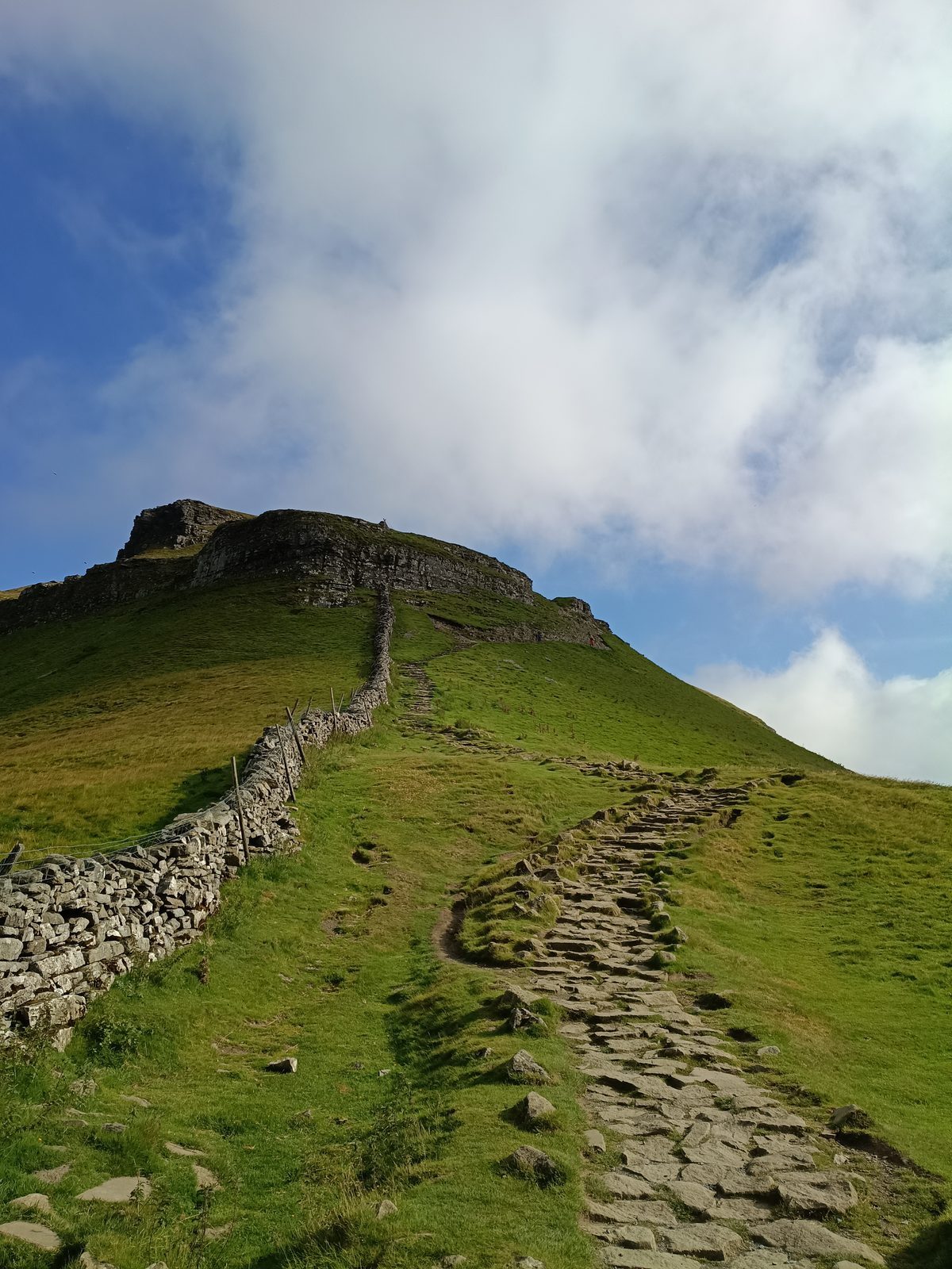
The smallest of the three but a proper scramble near the top. Don't be fooled by the early energy in your legs — this is just the warm-up. Start steady.
The highest of the three. The approach from Ribblehead is one of the finest ridge walks in England. By this point your legs will know they're working.
The final summit, and the one that breaks people. After 20 miles the climb to the plateau feels brutal. But the views from the top make every step worth it.
Starting the Route
The most popular start point is Horton-in-Ribblesdale in the Yorkshire Dales. There's a pay and display car park, a train station on the Settle–Carlisle line, and the famous Pen-y-Ghent Café which has been clocking walkers in and out for decades. If you want the official challenge stamp, check in at the café before you set off.
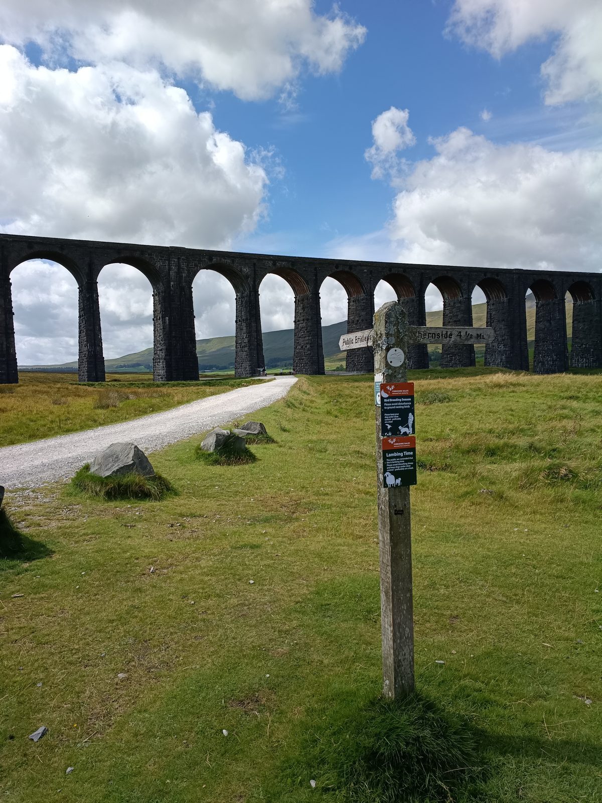
The route is a circular — you always finish where you started. Set off clockwise (Pen-y-Ghent first) and you'll pass Ribblehead Viaduct between peaks two and three, which is one of the finest views in the Dales and a good spot to refuel.
Checkpoint Times
These are realistic times for a reasonably fit walker moving at a steady pace with short breaks. Use them to gauge your progress on the day — if you're running significantly behind at Ribblehead, have a honest conversation about whether to continue.
| Checkpoint | Distance | 10hr finish | 12hr finish |
|---|---|---|---|
| Start — Horton-in-Ribblesdale | 0 miles | 07:00 | 07:00 |
| Pen-y-Ghent summit | 3.5 miles | 08:30 | 09:00 |
| Ribblehead Viaduct | 11 miles | 11:00 | 12:00 |
| Whernside summit | 14 miles | 12:30 | 13:45 |
| Chapel-le-Dale | 17 miles | 13:30 | 15:00 |
| Ingleborough summit | 20 miles | 15:00 | 16:30 |
| Finish — Horton-in-Ribblesdale | 24 miles | 17:00 | 19:00 |
Tips From the Trail
Pen-y-Ghent feels easy. Save it. You've got 21 miles after the first summit. The people who blow up are always the ones who pushed hard at the start.
Yorkshire weather changes in minutes. I've been caught in horizontal rain at Ribblehead on a day that started in sunshine. Waterproofs are non-negotiable.
Don't debut new footwear on a 24-mile day. Train in the boots you'll wear. Your feet will know the difference by mile 18.
Once your energy dips on a walk this long it's hard to recover. Eat and drink little and often from the first mile, not just when you feel like you need it.
Signposting is patchy, especially on the higher ground. Download the GPX before you go and keep your phone charged. A small power bank is worth the weight.
The Three Peaks is about sustained effort over distance. Back-to-back walk days, hill training, and time on your feet are what prepares you — not just general fitness.
Get the Free
Yorkshire 3 Peaks GPX
The full 24-mile circular route from Horton-in-Ribblesdale. Load it onto your phone, Garmin or OS Maps before you set off.
Free to download. No sign-up required.
Ready to Actually Train for It?
Get Fell-Ready is my 8-week hiking training plan built specifically for people taking on big UK challenges like the Yorkshire Three Peaks. Progressive training, back-to-back days, hill work — everything you need to get round.